
Connect Your Drone
Enter your mavlink2rest endpoint. Browser handshake takes under two seconds. No driver install, no Windows-only tools.
MAVLink Endpoint
ws://192.168.1.100:8080
Connect
A Canadian-owned Ground Control Station that runs in any browser. Open core under GPL-3.0. Transport Canada compliance built in. Your telemetry stays on Canadian infrastructure.
No credit card. No signup. Sandbox pre-loaded with a survey mission.
QGroundControl dates from 2009. Mission Planner runs Windows only. No Canadian provider owns the data. No open core. No compliance stack.
Enter your mavlink2rest endpoint. Browser handshake takes under two seconds. No driver install, no Windows-only tools.
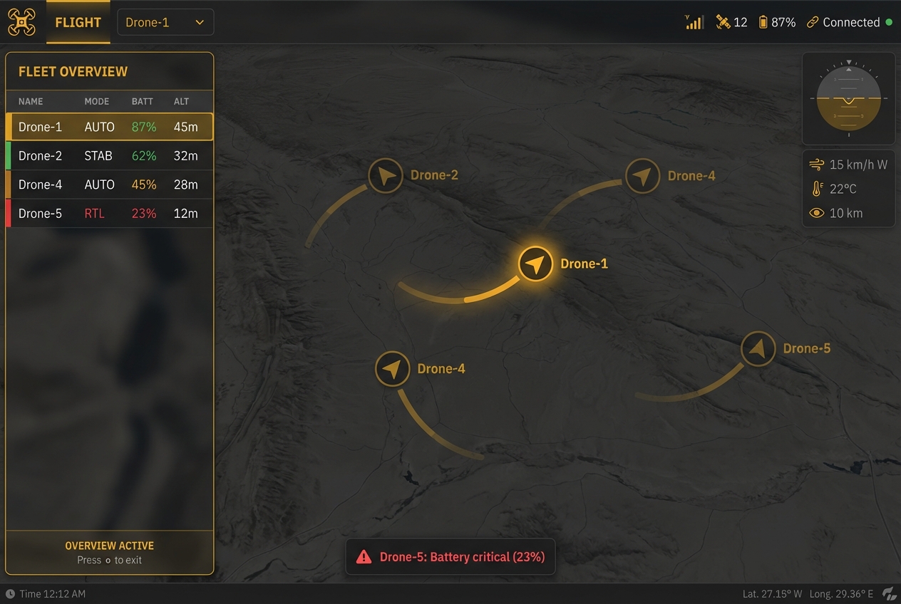
Drop waypoints on a 3D terrain map. Set altitude, overlap, pattern. Upload to the drone in one click.
Every flight is logged server-side. Generate Transport Canada CARS 901.48 reports in one click. Pro feature.
The browser GCS is forked from ADOS Mission Control under GPL-3.0 — you can self-host the entire flight experience. The cloud services (fleet management, compliance reports, weather API) are proprietary and run on Cloudflare Workers.
1  import { MavlinkMessage, MavlinkSystemId } from './mavlink';
2  import { EventEmitter } from 'events';
3
4  /**
5   * Handles the core MAVLink connection logic, including heartbeat
6   * management and component targeting.
7   */
8  export class MavlinkConnection extends EventEmitter {
9    private systemId: MavlinkSystemId = 1;
10   private targetSystemId: MavlinkSystemId | null = null;
11   private targetComponentId: MavlinkComponentId | null = null;
12
13   constructor() {
14     super();
15     console.log('MAVLink connection initialized.');
16   }
17
18   public onHeartbeat(message: MavlinkMessage): void {
19     // Update system status and target if needed
20     if (this.targetSystemId === null) {
21       this.targetSystemId = message.systemId;
22     }
23     console.log(`Heartbeat received from system: ${message.systemId}`);
24     this.emit('heartbeat', message);
25   }
26 }
Indigenous-owned through the Procurement Strategy for Indigenous Business (PSIB). Full data sovereignty on Canadian soil. Edge mode for classified deployments without internet. Compliance with Transport Canada CARS 901.48. Air-gapped options for arctic and remote operations.

No credit card required. Sandbox pre-loaded with a survey mission.